Yesterday I left off pondering the overnight evolution of the present cold pool. Today we have the answers, which is one of the great things about studying atmospheric science... you get to test your hypotheses everyday.
The 12 UTC sounding from the Salt Lake Airport indicated a nearly isothermal lapse rate between the surface and 700 hPa (with some shallow inverted layers). The modifications of the thermal structure overnight where relatively modest, with slight warming near 700 hpa and virtually no change in the surface temperature.

In fact the surface temperature at the Salt Lake Airport was 27 F at both 5 Pm on Tuesday and 6 AM on Wednesday. Why so consistent? Well, the surface temperature and the cloud base temperature were nearly identical, meaning that the longwave radiation emitted from the surface was nearly identical to that received from the clouds... and now that we have all this fancy instrumentation in place we can even demonstrate that this was the case. Below is a plot of the net radiation at the ISFS sites which are scattered throughout the valley.

Note that most sites were almost exactly zero through the overnight hours, where as on a clear night (when the earth tries to equilibrate with the background temperature of the vacuum of space) the net radiation would be negative as it is at the right hand side of the plot (clearing this evening). Despite the lack of production of cold air at the surface, the presence of warm air aloft (which is potentially warmer than the air at the surface) maintained strong stability, a scenario which qualifies as a cold air pool.
Stability would only increase through the day as warm air advection (or possibly still subsidence) pushed temperatures in the layers between 750 and 800 hPa up above the freezing point while surface temperatures remained cool due to the limited insolation and snow on the ground. Much of the temperature contrast was realized in a shallow but extreme inversion layer near 800 hpa. These changes are shown below in the 18, 00, and 06 soundings. The 18 and 06 soundings (green) are the first rawinsondes launched as part of the PCAPS campaign and are already proving to be an amazing asset in understanding the evolution of these events.

It is also apparent from ceilometer measurements, visual clues, and increasing relative humidity that this event is trying hard to transition to a cloudy/foggy cold pool.
Check out the ceilometer plot, which shows the possible onset of boundary layer clouds around 10 PM on Wednesday night here
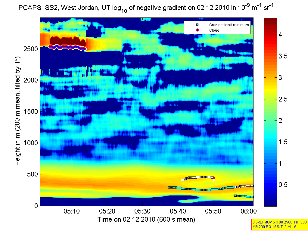
Now the big challenge for the PCAPS team is trying to assess when and how this event will conclude. A relatively weak system is expected to impact the region midday Friday, but it is unclear whether the cold pool will persist or not. With air quality rapidly deteriorating in the valley with each passing day the outcome of Friday may have significant impacts on the inhabitants of the Salt Lake Valley.
If you want to keep tabs on the data stream yourself please link here and browse the various data sources which are now online.
No comments:
Post a Comment